Get Started Tracking At-Risk Animals Using GIS Data
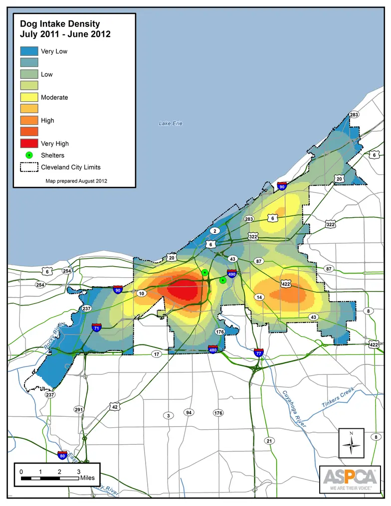
Geographic Information Systems (GIS) help target the most at-risk animals in communities so shelters can:
-
See their communities through real data rather than assumptions or generalizations
-
More clearly understand where the most at-risk animals are coming from
-
Determine where it makes the most sense to plan targeted interventions
Using data that's at least 80% clean and accurate, shelters can then use GIS to help save more lives.
Prepare to Use GIS
Implement GIS
- Cleaning Your Data Guide
- Clean Address Poster (PDF)
- Step-By-Step Videos
- Core Statistics and Map Index (PDF)
ASPCA X Maps Spot Project
-
Effects of a Geographically-Targeted Intervention in Portland, Oregon (PDF)(Open Journal of Animal Sciences, 2014)
The ASPCA X Maps Spot project was funded by PetSmart Charities©
We have lots more on this subject:
Topics:
Keeping Pets in Homes
,
Safety Net
Type:
How-Tos